
Lauchernalp - Lötschental
About Lauchernalp - Lötschental
The Lauchernalp-Lötschental ski area in Switzerland is a snow-sure, high-altitude winter sports area with 38 to 55 km of slopes, known for its exceptional freeride and off-piste opportunities. The area offers a mix of challenging slopes for experienced skiers and wide, sunny runs for families, reaching a peak of 3,100 meters. With a car-free village, access to long winter hiking trails, and easy access by train via the Lötschberg Tunnel, it is a picturesque destination suitable for both active winter sports enthusiasts and those seeking peace and quiet.
Plan your stay in Lauchernalp - Lötschental
Compare hotels, chalets and apartments in and around Lauchernalp - Lötschental — book instantly with free cancellation on most rates.
Ski Area Map
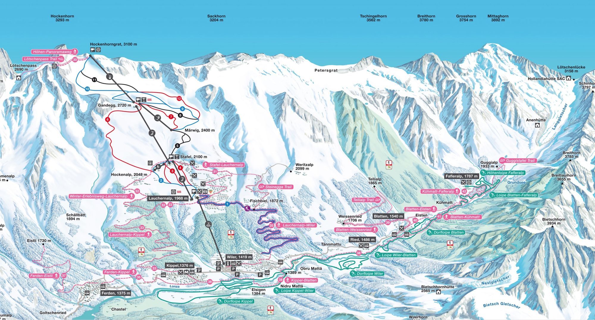
Official ultra-high resolution ski area map showing all slopes, lifts, villages, and mountain facilities. Features detailed terrain information with difficulty levels and connection points between villages.
Current weather
Weather Station • 1423m
Season & slopes
Key facts at a glance — open the tab for live slopes and lifts.
Resort Features & Highlights
Skiing & Snowboarding
Resort Amenities
Live Resort Status
No live status data available
Snow Conditions
Off-season — live snow depth resumes when ski areas reopen.
Season Information
Technical Details
Location & Contact
Address:
Wallis, Switzerland
Coordinates:
46.40315°N, 7.78161°E
Similar ski areas
Discover other ski areas that match this resort.


